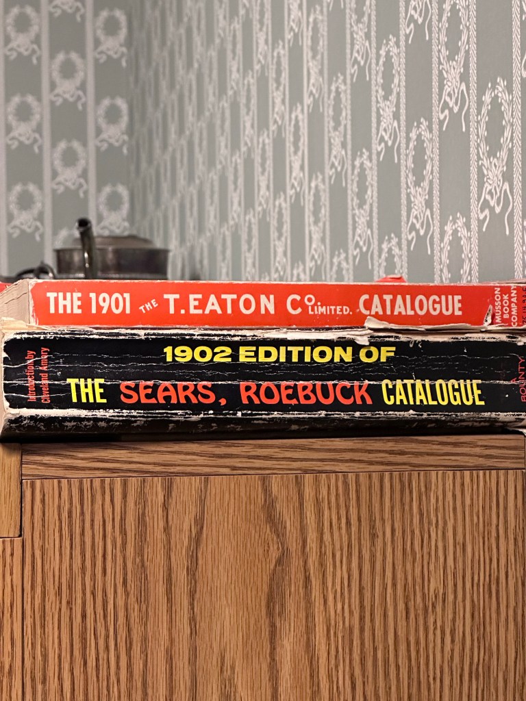
It‘s very difficult to gauge a town‘s importance, fuel, or accommodations capacity from the map. All the towns are dots. Up here Web content is also of limited volume. And so it is with Teslin, Yukon Territory.
After tanking information from the main Teslin museum, I partition the town’s development into three phases: Pre WWII, WWII, and post war. The museum centers around one indigenous man, George Johnston (1884-1972). Here the selected items that make him stand out.
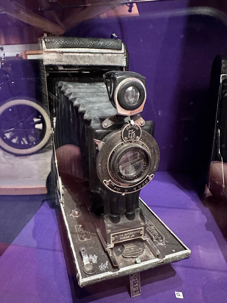
No formal education. A fur trapper in the Teslin area, i.e. the middle of nowhere in the Yukon. Traveled to Juneu in 1900, where he learned about cars, cameras, and a bit of English. Back home, he ordered a camera from Eatons Mailorder, plus development supplies. He then proceeded to build a darkroom in the wilderness. His photos are all of Tlingit people and customes, and are historically significant.
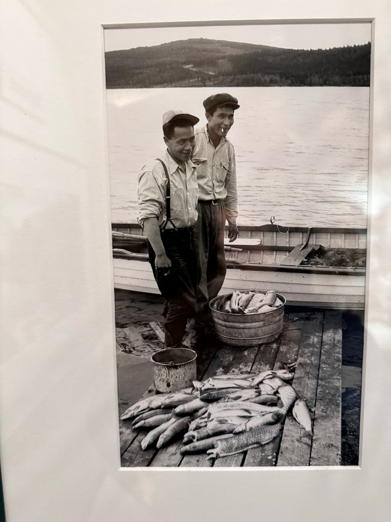
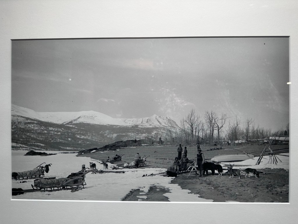

He retained the local rhythm of living out in the woods for trapping, which is best in Winter, and trading at Teslin in late spring and summer. He was a business man.
However, he wanted a car, because he thought it was cool, and the future, as he had seen in Juneau. One dealership owned General Motors dealership for all of the Yukon. This despite only wagon trails being available at best. Forward looking, though maybe by quite a few years.


I have no idea where he got his 91 octane gas! But he cleared four miles around Teslin, and offered taxi service. Mostly, though, he painted the car white in the Winter, and drove it on the long, frozen Teslin lake to check his trap lines. For Summer, he went black again.
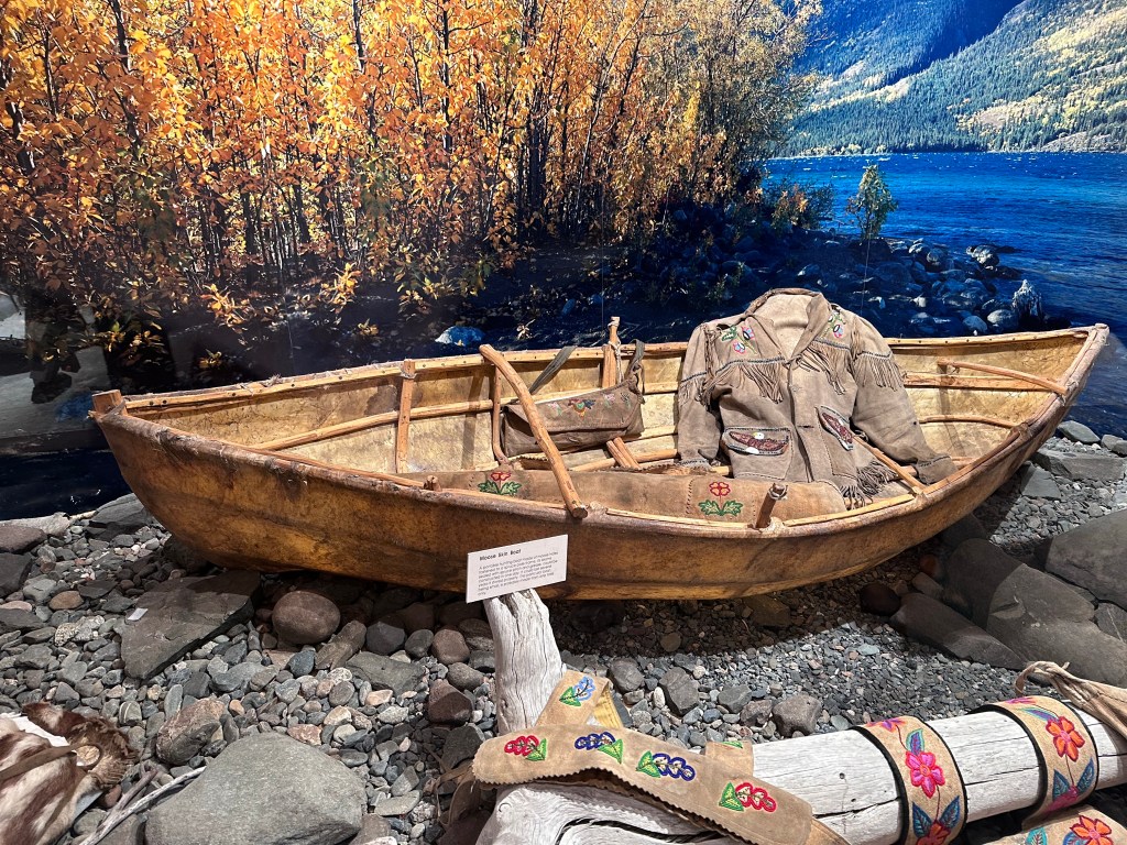
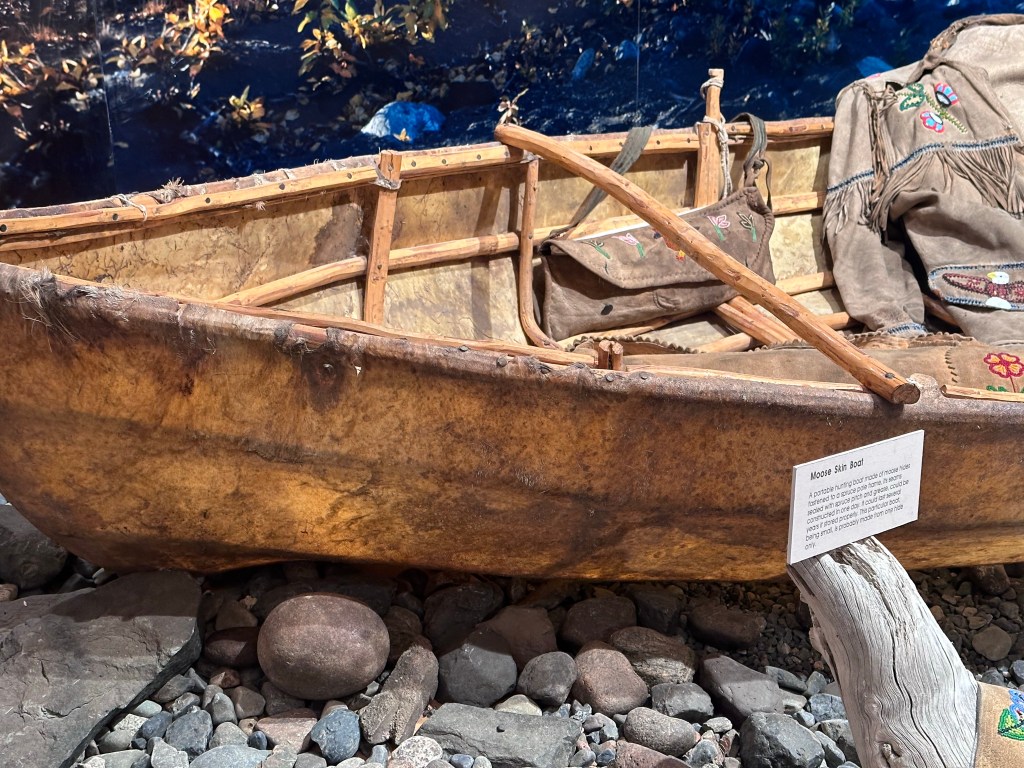
Other Transport
I’ve never seen this type of boat. Made from the skin of a single moose, and put together in a day. Looks light enough to portage easily.

WWII and the Alaska Highway
Before WWII the US wanted a land route between Alaska and the US. Primarily for military uses.
„How‘bout we build a road through your Yukon into your British Columbia,” asked the US, “We pay some, you pay some. And then we can run military stuff up there?“
Canada declined. Politely, I‘m sure. After Pearl Harbor, Roosevelt knocked again:
„How‘bout we build a road through your Yukon between Alaska and your British Columbia, so we can run military shit through there to Alaska against the Japanese.“
„Not a bad idea,“ said Canada, „You pay for it, but get US sovereignty through that whole corridor. Soon after the war, the road is ours.“
„Cool,“ said „Roosevelt. We‘ll do that.“
Within eight months the US Army Corps of Engineers built the 1,700 miles of road. From the US military budget. Not a nice road. But good enough for convoys of trucks. What did that process look like?
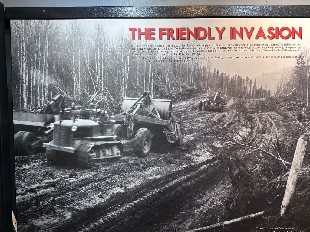
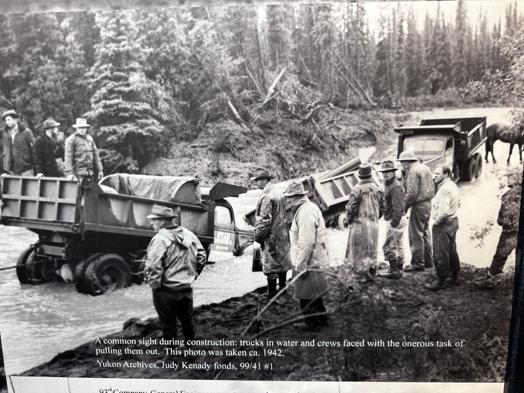

Since the native population looked kind of Japanese, they were stopped at military checkpoints. That‘s US military, remember. Obviously the Army Corps didn‘t worry about trap line locations, winter housing, burial grounds, and silly details like that.
As usual, smallpox, measles, etc. took a significant toll, even though both the US and Canada knew about the absence of antibodies in that population. The relationship between whites and the local population doesn’t sound like the earlier genocide scenarios of the US Westward expansion. Just indifference, and, obviously, fear of Japan.
WWII and Bombers to Soviets
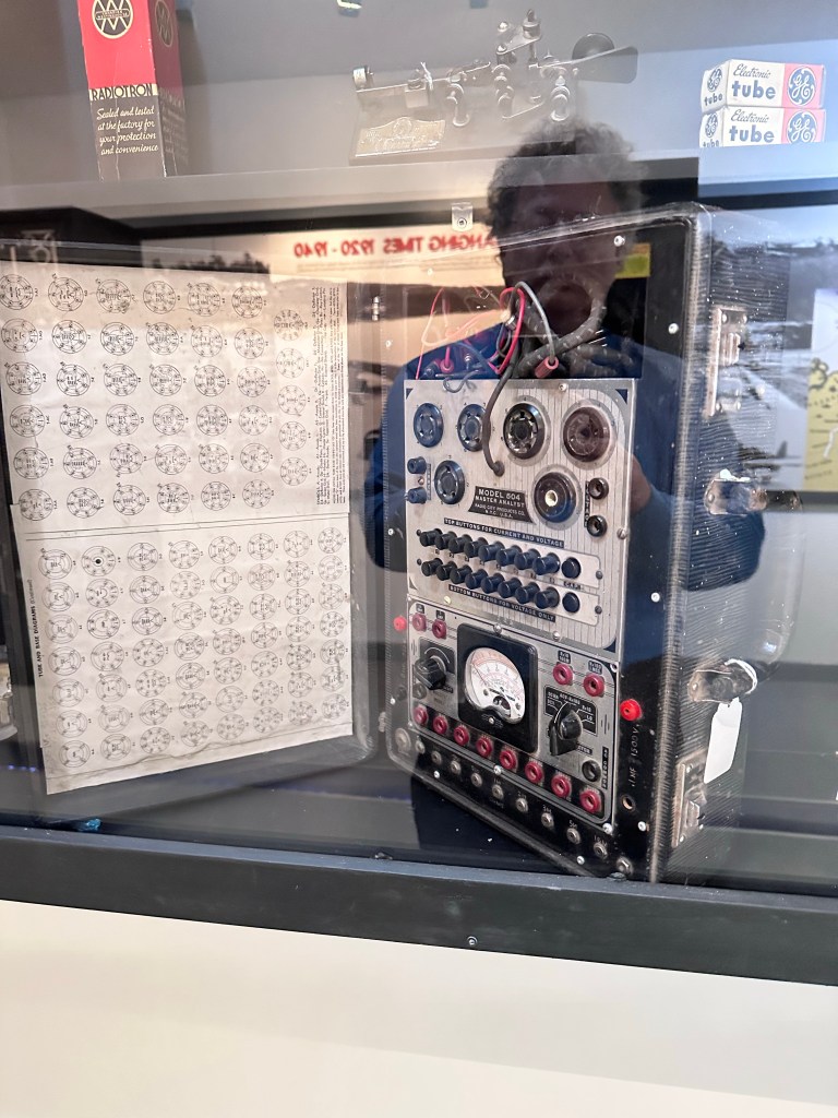
Now, I love this part, even if it’s a bit technical. Just skip it if uninterested in 1930s/40s air traffic navigation. But I warn you: it is cool material. I hope that I am properly understanding and describing the details. Maybe there is an engineer, or even an engineer-pilot among you readers to set me straight.
During the US initial period of neutrality, the States supported the Soviets via the lend-lease act. Bombers and other planes were delivered to Alaska, where Soviet pilots picked them up. American pilots flew the machines from US factories to their Alaskan destination.
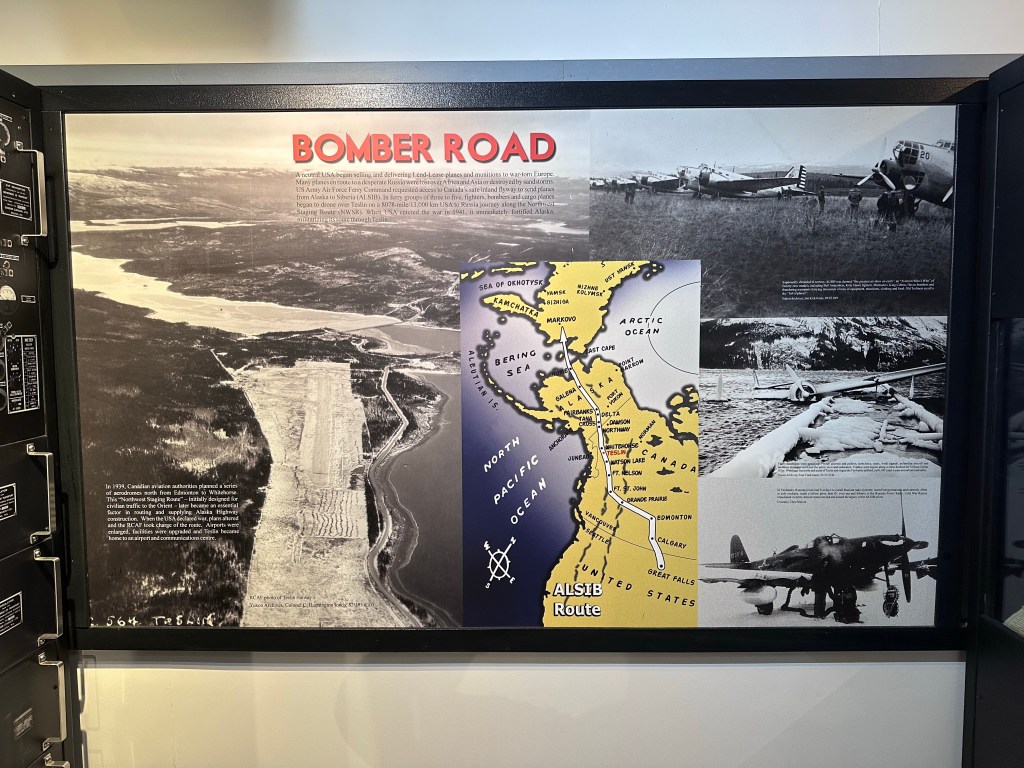
Without modern air traffic control and GPS, how did the US pilots find their way to the Alaska handover spot—in all kinds of weather?
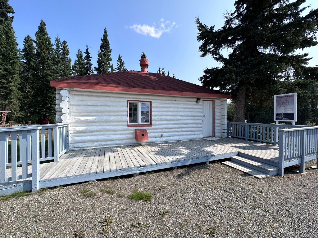
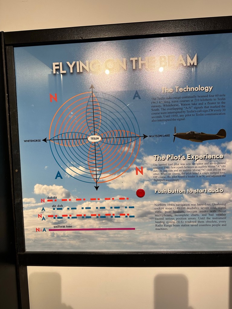
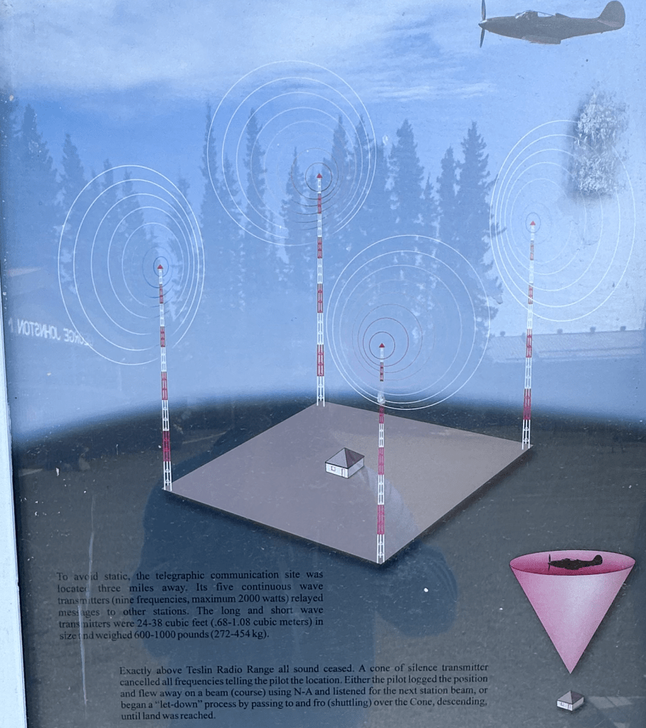
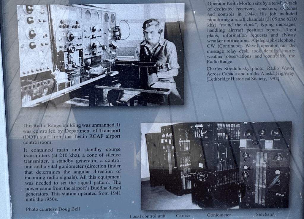

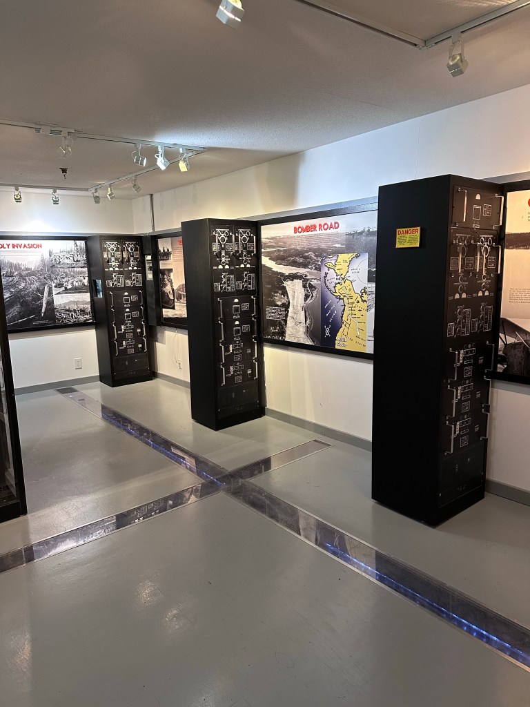
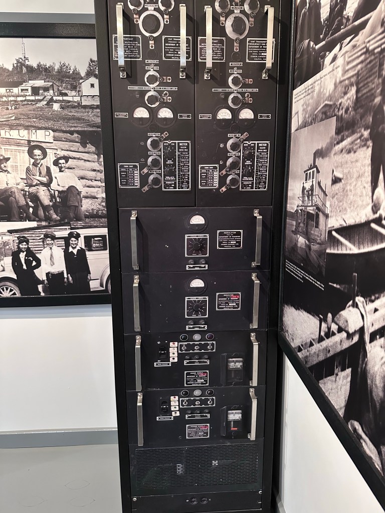
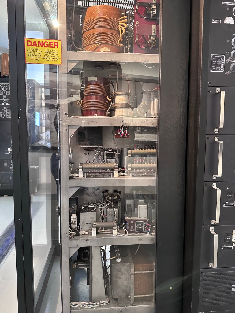
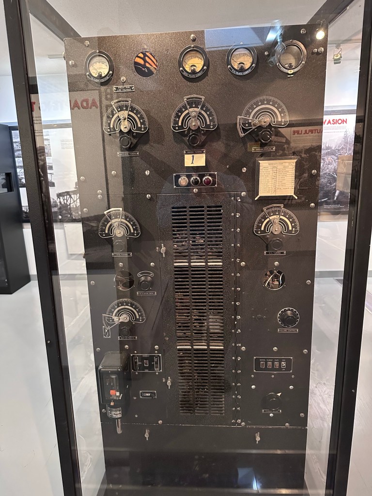
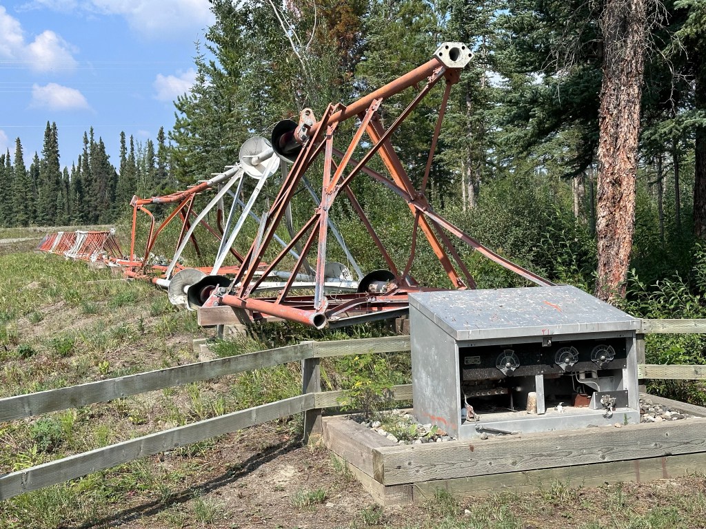
The white building is the only one left of around 50 unmanned navigation stations that provided navigation radio signals for pilots to fly by. Some miles away from this stations was an additional radio communications center for separately transmitting weather, etc. to pilots, without interfering with the navigation signals.
And the navigation part really is something else (see top middle image). Two of four transmitters continuously sent the Morse code for “n”: dah-did. The other two transmitted the letter “a”: did-dah. Signal strengths were carefully maintained to be the same for all four transmitters. And their strength went up and down at the same moments (they were in phase).
The transmitter antennas were arranged so that the proper course for the pilots was right between the transmitters:
Did-dah. Dah-did
<——————————————————
Dah-did. Did-dah
If the plane flew far away from course, the pilot would hear either did-dah, or dah-did. If the plane was somewhere between the towers, but not exactly dead on track, a mix of the two signal would be heard.
But if the pilot was right on course, they would hear one continuous sound, because a repeated:
did-dah + dah-did = daaaaaah…
That’s because overlaying the long dah over a short did makes you hear the long dah, despite the did’s silence for part of the time.
The way I understand it, the above provides the pilot with a heading (proper direction of his nose). But still missing is the location. They communicated that part with a fifth transmitter that ‘negated’ all signals above the transmission building, providing silence for the pilot for a moment as the plane flew over. To tell the pilot which cone of silence they had found, an additional station-specific designator was Morsecode transmitted every 30 seconds.
Presumably the engineers were able to get this cone of silence reasonably clean because the military were mostly the only ones on these frequencies, and could thus accomplish the cancellation.
I would hate to have been responsible for either hardware, or operation of these stations. Way too much pressure.
Teslin Today
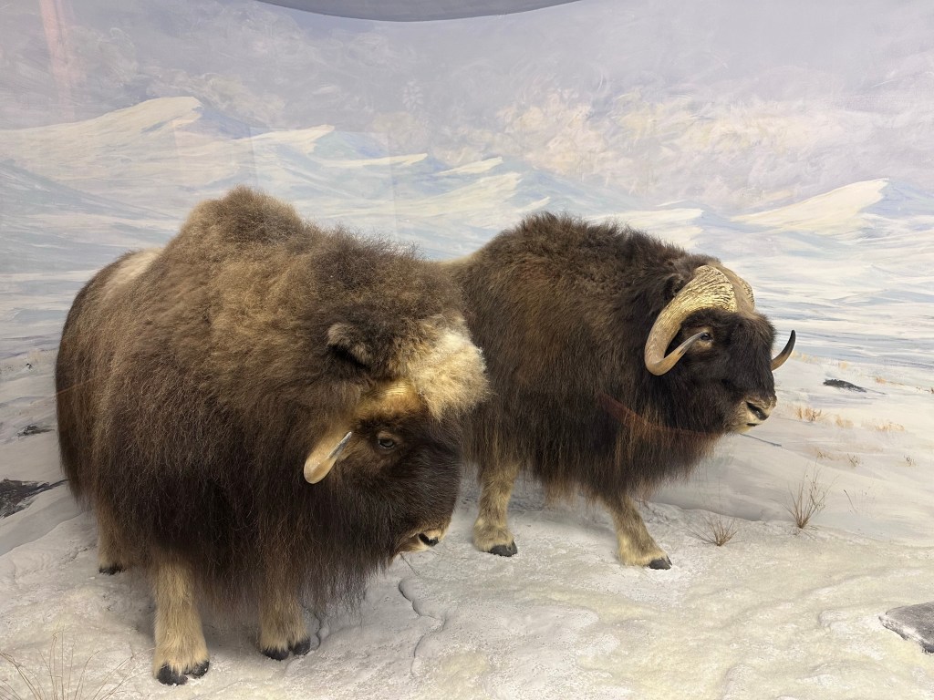
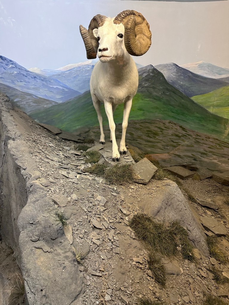
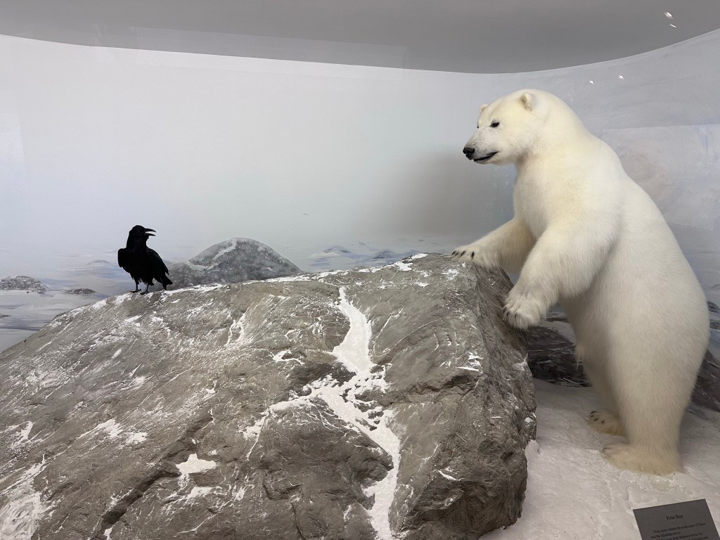
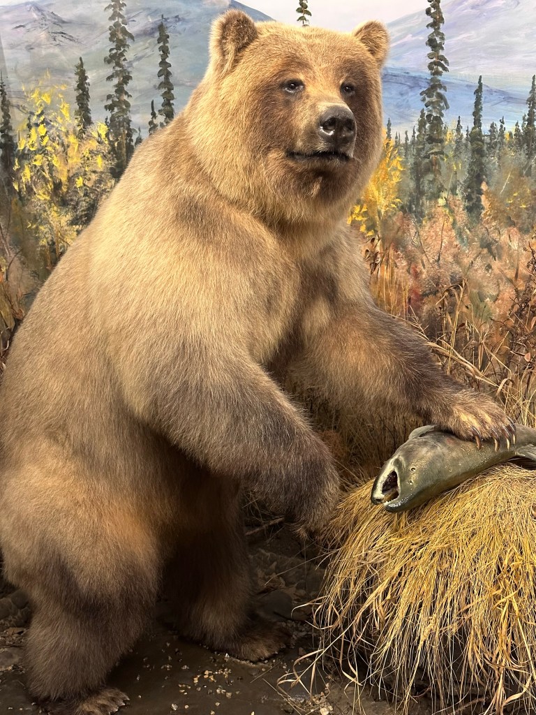
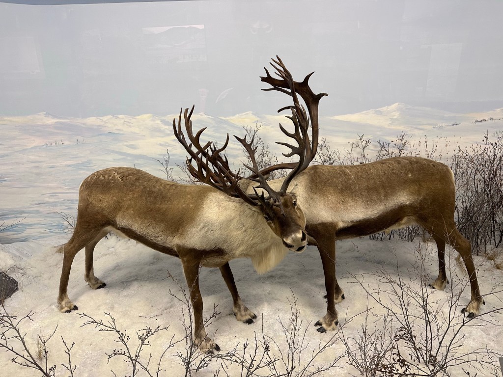
Amazing Wildlife Taxidermy Museum
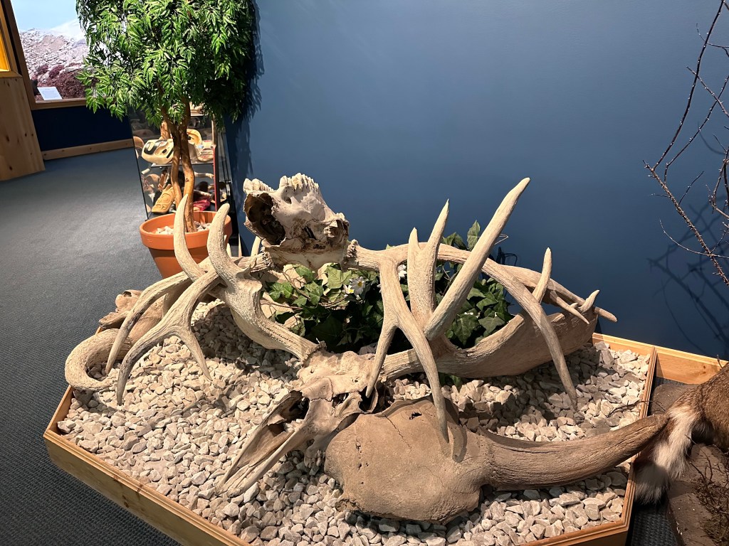
A second museum in Teslin, with beautiful wildlife scenes:
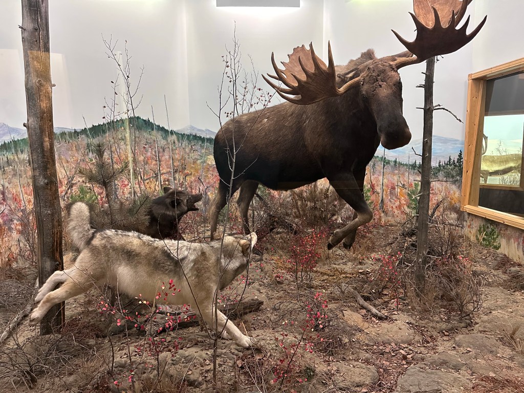
And here is a lesson from the animal world: No girl is worth this:
The following image is utterly ambiguous:
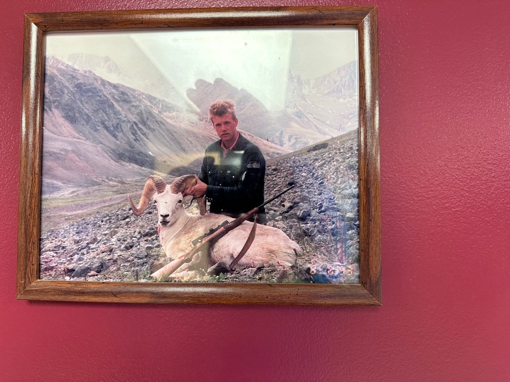
Interpretation 1:
“I just shot this mountain sheep with my rifle. I am holding up the head, so the sheep doesn’t arouse too much empathy, lying there, and raise disgust against me, who shoots mountain sheep that have a hard enough life as it is.
Interpretation 2:
This is my mountain sheep buddy. She is a very bitter sheep, and hates rams above all. She’ll pretend to be estrous, and I shoot any males that come running. Then my buddy and I just laugh and laugh and laugh.
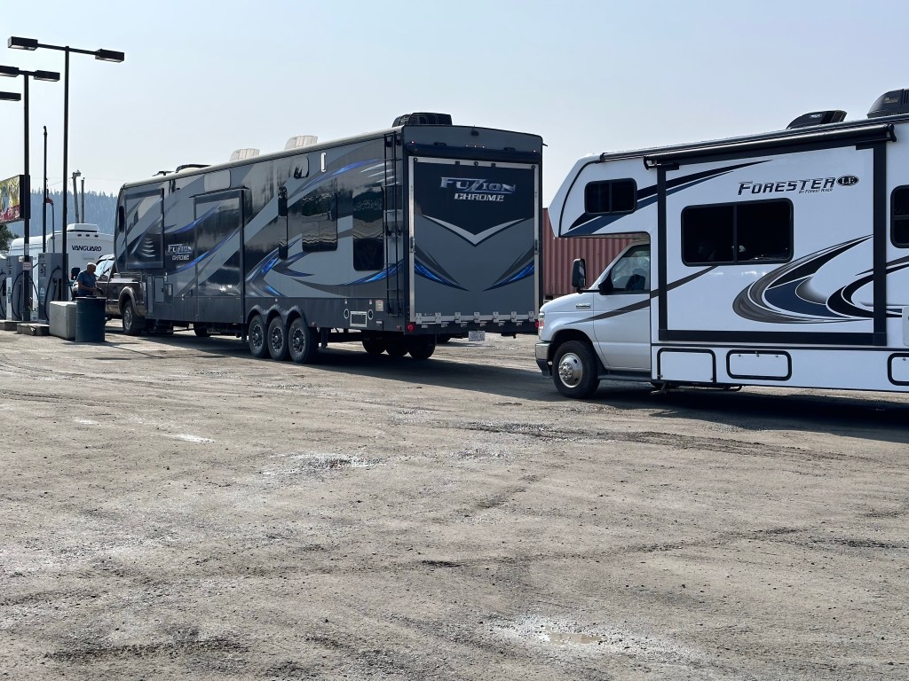
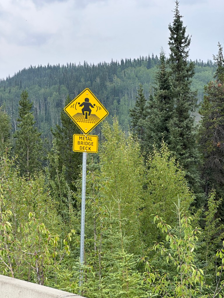
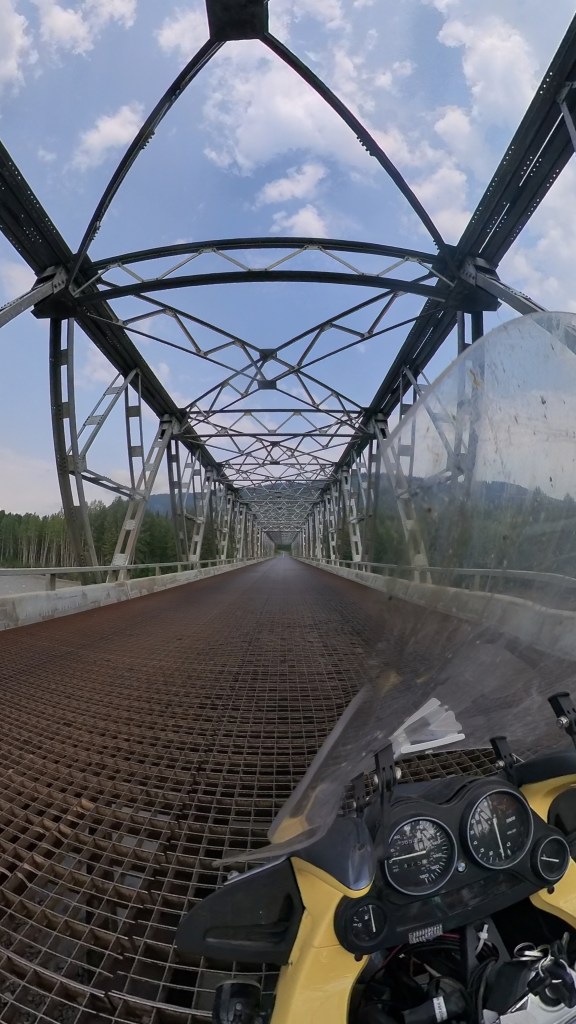
Along the way to Teslin
Some bikers dislike bridge grill flooring. You do have to get used to the feeling of the bike ‘weaving’ a bit. And there is the brrrrr sound. But Canada has a special warning sign for the effect!

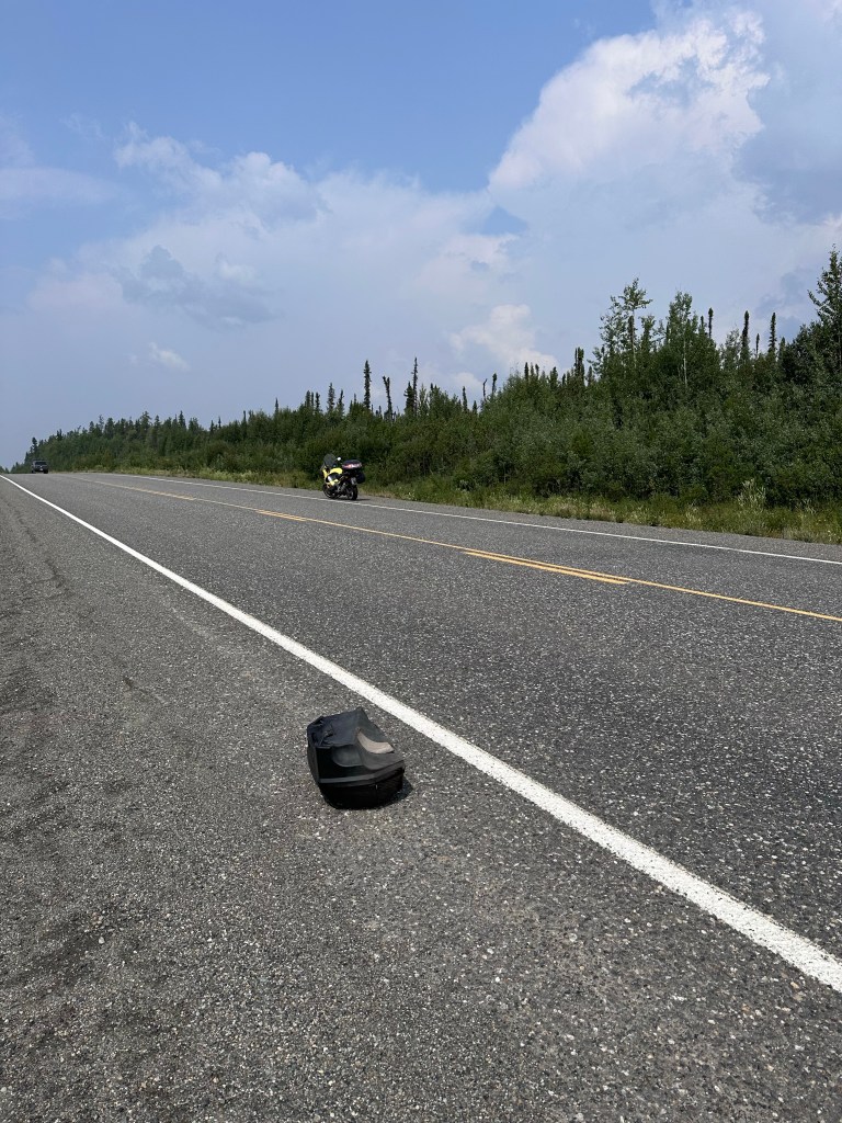
Along the way, likely 70mph, I heard a rumble, and in my rear view mirror saw my left luggage case flying, jumping and rolling on the Alaska Highway like tumbleweed. Fortunately, the truck behind me was far enough away not to make contact. The case obligingly ended up on the side of the road. Unbroken.
Any vehicle’s collision with the case would have been quite dangerous.
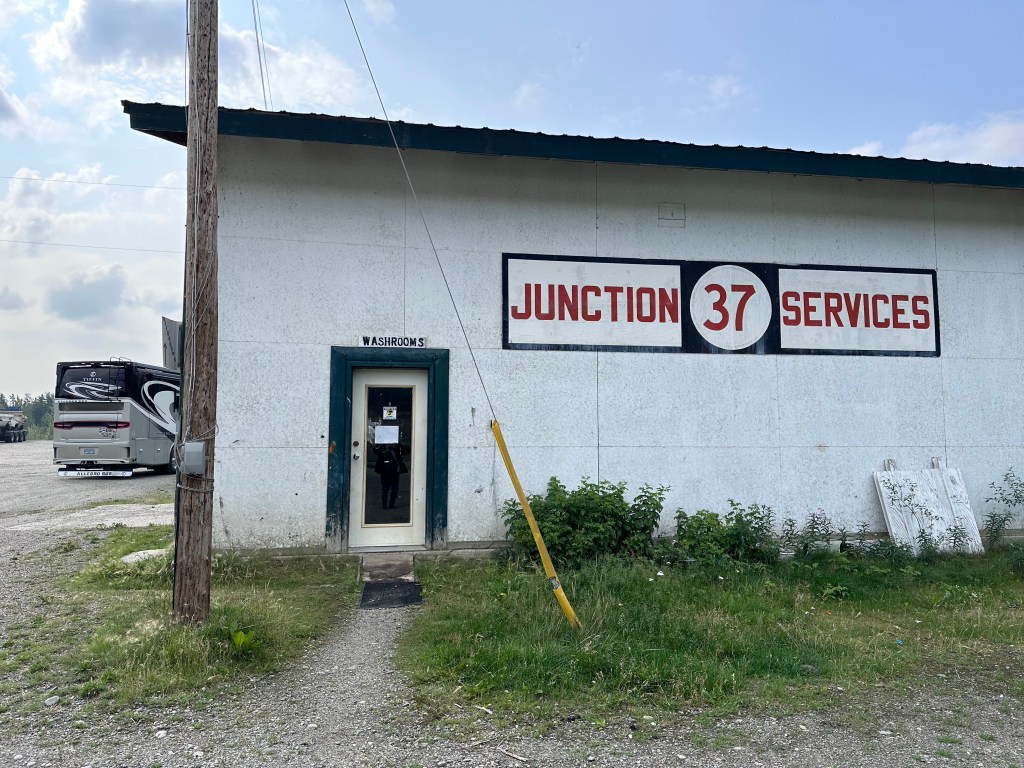
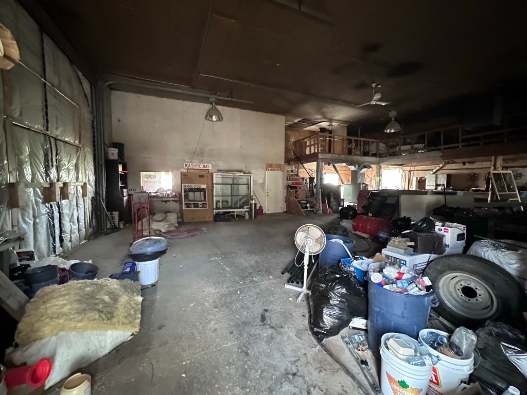
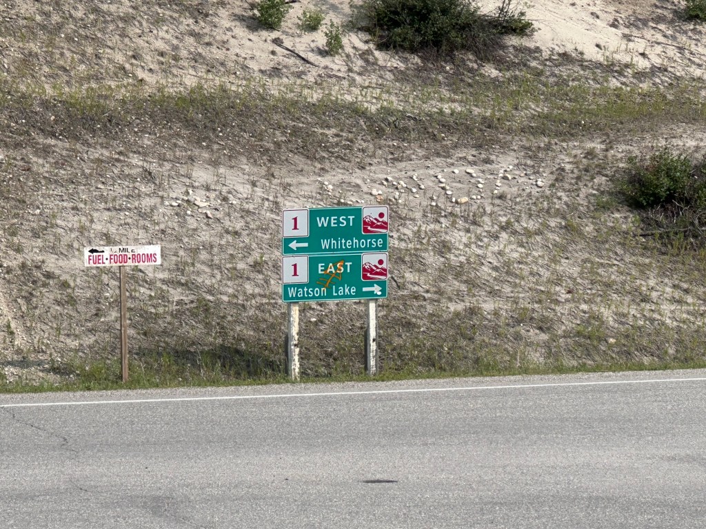
The Great Junction
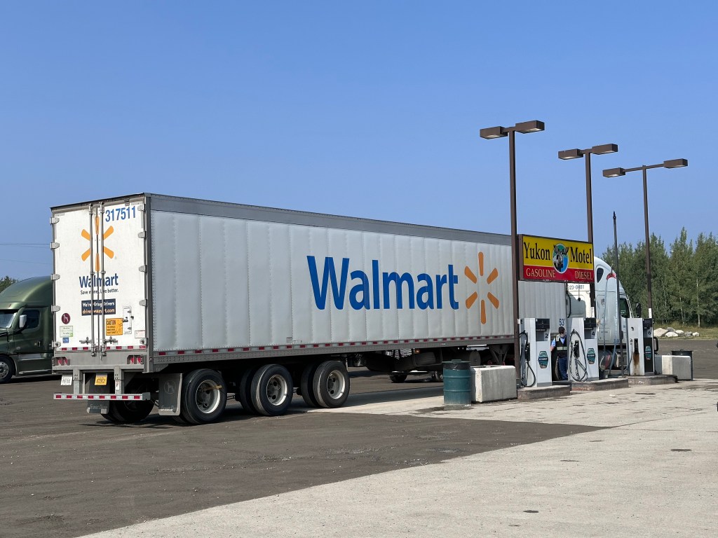
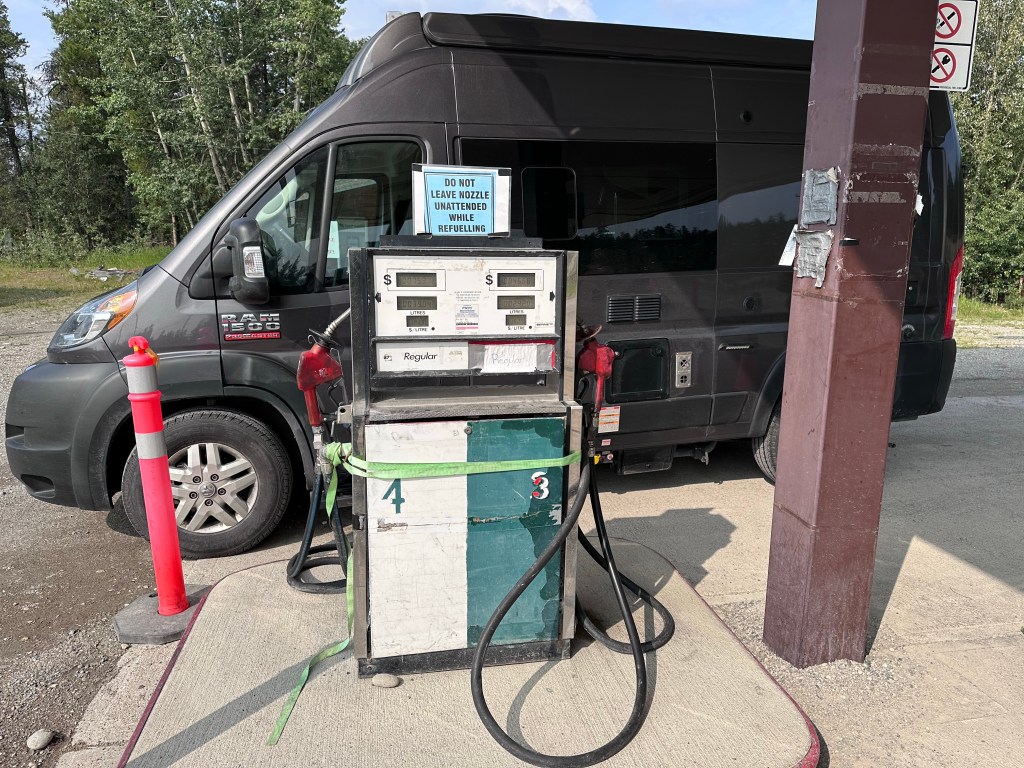
You now know about the Alaska Highway, and you know that just two roads lead up to the Yukon, and therefore that highway. I came up the 37, the one without cell, and barely any other services. So I expected that where the great East-West Alaska Highway meets the scenic North-South 37 would be a special spot. One with a restaurant, Chevron, Shell, 91 Octane.
And of course, there will be a great restroom: